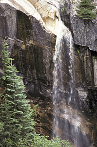
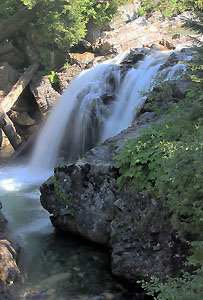
 Keekwulee Falls
Rating: **
Form: tiered
Magnitude: 34 (l)
Access: trail (page 44)
USGS Map: Snoqualmie Pass (1989)
Edition: 1st
 Keekwulee Falls
Rating: **
Form: tiered
Magnitude: 34 (l)
Access: trail (page 44)
USGS Map: Snoqualmie Pass (1989)
Edition: 1st
 Franklin Falls
Rating: ***
Form: plunge
Magnitude: 59
Access: auto (page 44)
USGS Map: Snoqualmie Pass (1989)
Edition: 1st
 Fall into the Wall (u)
Rating: **
Form: punchbowl
Magnitude: 41
Access: auto (page 44)
USGS Map: Snoqualmie Pass (1989 ns)
Edition: 5th
More
Click Here for Snowshoe Falls, USGS Snoqualmie Pass (1989).
Output the CLICK HERE page to match your hardcopy book by changing your printer settings to 9" x 5 3/4".
Others
Cole Creek Falls (u), USGS Easton (1989 nl), occurs in local terrain that makes it too hazardous to attempt to see.
Found within Alpine Lakes Wilderness, one or more of these waterfalls may be distantly visible from a trail: Gold Creek Falls (u), USGS Chikamin Peak (1989 nl), Lemah Valley Falls (u), USGS Chikamin Peak (1989 nl), and Upper Lemah Creek Falls (u), USGS Chikamin Peak (1989 nl), Middle Lemah Creek Falls (u), USGS Chikamin Peak (1989 nl), and Lemah Creek Falls (u), USGS Chikamin Peak (1989 nl).
The following cataracts are located within the Cedar River
Watershed, which is closed to public entry:
Findley Creek Falls (u), USGS Findley Lake (1989 nl),
Seattle Creek Falls (u), USGS Findley Lake (1989 nl),
North Fork Cedar Falls (u), USGS Findley Lake (1989 nl) and
Viola Creek Falls (u), USGS Findley Lake (1989 nl).
East Fork Falls (u), USGS Lester (1989 nl),
Friday Creek Falls (u), USGS Lester (1989 nl),
Twin Camp Falls (u), USGS Lester (1989 nl) and
Upper Twin Camp Falls (u), USGS Lester (1989 nl) are
also inaccessible due to their being within the Green River Watershed.
Go to next section of North Cascades
Go to previous section of North Cascades
North Cascades Contents
North Cascades Index
Master Table of Contents
Master Index
Perform a Selective Search
View Chronological List of Additions
View Chronological List of Updates
Place
a Book Order Online
COPYRIGHT 2013 by Gregory A. Plumb
GUIDEBOOK published by
Mountaineers Books