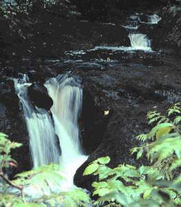
 Porter Falls
Rating: **
Form: punchbowl
Magnitude: 32
Access: trail (page 108)
USGS Map: Malone (1993 nl)
Edition: 3rd
 Porter Falls
Rating: **
Form: punchbowl
Magnitude: 32
Access: trail (page 108)
USGS Map: Malone (1993 nl)
Edition: 3rd
More
Click Here for Mima Falls, USGS Littlerock (1993).
Output the CLICK HERE page to match your hardcopy book by changing your printer settings to 9" x 5 3/4".
Others
Rock Creek Falls, USGS Malone (1993 ns), is labeled on the
State Forest map as a point of interest, but no trails are shown leading
to it. Dean Creek Falls (u), USGS Dean Creek (1994 nl), is
probably on private property with unknown access.
COPYRIGHT 2013 by Gregory A. Plumb
GUIDEBOOK published by
Mountaineers Books