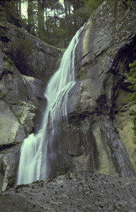
 Silver Falls
Rating: **
Form: segmented
Magnitude: 21 (t)
Access: trail (page 248)
USGS Map: Golden Falls (1990)
Edition: 1st
 Silver Falls
Rating: **
Form: segmented
Magnitude: 21 (t)
Access: trail (page 248)
USGS Map: Golden Falls (1990)
Edition: 1st
 Golden Falls
Rating: ***
Form: horsetail
Magnitude: 34
Access: trail (page 249)
USGS Map: Golden Falls (1990)
Edition: 1st
Others Access is uncertain to
Matson Creek Falls (u), USGS Golden Falls (1990 nl),
Upper Matson Falls (u), USGS Golden Falls (1990 nl),
Stulls Falls, USGS Elk Peak (1985),
Henrys Falls, USGS Allegany (1971),
Pigeon Falls, USGS Allegany (1971),
Estell Falls, Allegany (1971 ns),
Elk Creek Falls (u), USGS Ivers Peak (1990 nl),
Lower Elk Creek Falls (u), USGS Ivers Peak (1990 nl),
and
Beulah Creek Falls (u), USGS Ivers Peak (1990 nl).
Their maps imply no access to Darius Creek Falls (u), USGS Golden Falls (1990 nl),
Little Matson Falls (u), USGS Golden Falls (1990 nl),
Upper Little Matson Falls (u), both USGS Golden Falls (1990 nl),
East Millicoma Falls (u), USGS Ivers Peak (1990 nl),
West Millicoma Falls (u), USGS Ivers Peak (1990 nl).
COPYRIGHT 2013 by Gregory A. Plumb
Use the following Waterfalls for Intrepid Explorers hyperlink to access an index for information on exploring the following waterfall:
Coos Valley Falls (u), USGS Coos Mtn (1990 nl)
The following cataracts are reportedly visible from roads, but require a $350 annual Millicoma Tree Farm recreation lease from Weyerhaeuser: Hewett Falls, USGS Golden Falls (1990), Millicoma Falls (u), USGS Coos Mtn (1990 nl), Elk Creek Falls (u), USGS Ivers Peak (1990 nl), and
Lower Elk Creek Falls (u), USGS Ivers Peak (1990 nl).
Go to next section of South Coast Range
Go to previous section of South Coast
Range
South Coast Range Contents
South Coast Range Index
Master Table of Contents
Master Index
Perform a Selective Search
View Chronological List of Additions
View Chronological List of Updates
Place
a Book Order Online
GUIDEBOOK published by
Mountaineers Books