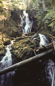
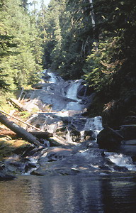
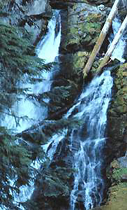
 Ranger Falls
Rating: ****
Form: tiered
Magnitude: 75
Access: trail (page 114)
USGS Map: Mowich Lake (1971)
Edition: 1st
 Ranger Falls
Rating: ****
Form: tiered
Magnitude: 75
Access: trail (page 114)
USGS Map: Mowich Lake (1971)
Edition: 1st
 Chenuis
Falls
Rating: **
Form: cascade
Magnitude: 39 (l)
Access: trail (page 115)
USGS Map: Mowich Lake (1971)
Edition: 1st
 Ipsut Falls
Rating: ***
Form: tiered
Magnitude: 45
Access: trail (page 115)
USGS Map: Mowich Lake (1971)
Edition: 1st
Carbon Falls (u)
Rating: **
Form: tiered
Magnitude: 50
Access: trail (page 115)
USGS Map: Mowich Lake (1971 nl)
Edition: 1st
 Cataract
Falls
Rating: ***
Form: segmented
Magnitude: 63
Access: trail and bushwhack (page 116)
USGS Map: Mowich Lake (1971)
Edition: 1st
More
Click Here for Lower Cataract Falls (u), USGS Mowich Lake (1971 ns).
Output the CLICK HERE page to match your hardcopy book by changing your printer settings to 9" x 5 3/4".
Alice Falls, USGS Mowich Lake (1971), is located
along Spukwush Creek adjacent to the Wonderland Trail, but is well hidden
by the surrounding vegetation.
Others
Views are also not likely of Cress
Falls, USGS Mowich Lake (1971) or
Crescent Creek Falls (u), USGS Mowich Lake (1971 nl).
COPYRIGHT 2013 by Gregory A. Plumb
GUIDEBOOK published by
Mountaineers Books