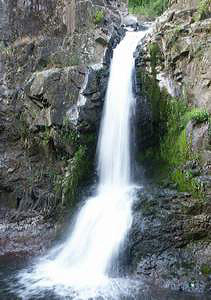
 Tom Tom Falls
Rating: **
Form: horsetail
Magnitude: 28
Access: trail (page 118)
USGS Map: Eatonville (1990 ns)
Edition: 3rd
Tom Tom Falls
Rating: **
Form: horsetail
Magnitude: 28
Access: trail (page 118)
USGS Map: Eatonville (1990 ns)
Edition: 3rd
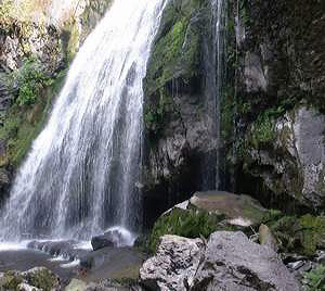 Little Mashel Falls
Rating: ***
Form: fan
Magnitude: 48
Access: trail (page 118)
USGS Map: Eatonville (1990)
Edition: 4th
More
Click Here for Deschutes Falls, USGS Bald Hill (1990).
Others
COPYRIGHT 2013 by Gregory A. Plumb
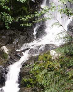 Lower Little Mashel Falls (u)
Rating: **
Form: segmented
Magnitude: 59
Access: trail (page 119)
USGS Map: Eatonville (1990 ns)
Edition: 4th
Click Here for Upper Deschutes Falls (u), USGS Bald Hill (1990 ns).
Output the CLICK HERE pages to match your hardcopy book by changing your printer settings to 9" x 5 3/4".
Wildcat Falls, USGS Lake Kapowsin (1993), is on private property with no access found. Access is
unknown to Tilton River Falls (u), USGS Mineral (1987 ns), Eagle Creek Falls (u), USGS The Rockies (1993 nl), Upper Eagle Creek Falls (u), USGS The Rockies (1993 nl), West Fork Tilton River Falls (u), USGS The Rockies (1993 nl).
Go to next section of Mount Rainier
Go to previous section of Mount Rainier
Mount Rainier Contents
Mount Rainier Index
Master Table of Contents
Master Index
Perform a Selective Search
View Chronological List of Additions
View Chronological List of Updates
Place
a Book Order Online
GUIDEBOOK published by
Mountaineers Books