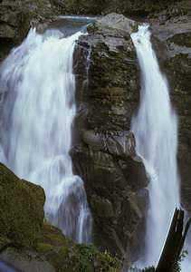
 Nooksack Falls
Rating: ****
Form: segmented
Magnitude: 97 (h)
Access: auto (page 69)
USGS Map: Bearpaw Mtn (1989)
Edition: 1st
Nooksack Falls
Rating: ****
Form: segmented
Magnitude: 97 (h)
Access: auto (page 69)
USGS Map: Bearpaw Mtn (1989)
Edition: 1st
 Wells Creek Falls (u)
Rating: **
Form: plunge
Magnitude: 65
Access: auto or bushwhack (page 70)
USGS Map: Mount Baker (1989 nl)
Edition: 2nd
Image courtesy of Aaron Young
More
Click Here for Lower Wells Creek Falls (u), USGS Bearpaw Mtn (1989 ns).
Output the CLICK HERE page to match your hardcopy book by changing your printer settings to 9" x 5 3/4".
Others
Use the following Waterfalls for Intrepid Explorers hyperlink to access an index for information on exploring the following waterfall yet to be visited by the author:
Excelsior Falls (u), USGS Bearpaw Mtn (1989 nl)
Upper Excelsior Falls (u), USGS Bearpaw Mtn (1989 nl)
Middle Wells Creek Falls (u), USGS Bearpaw Mtn (1989 nl)
Mazama Falls, USGS Shuksan Arm (1989)
Winchester Creek Falls (u), USGS Mount Sefrit (1989 nl)
Sholes Creek Falls (u), USGS Mount Baker (1989 nl) is not likely accessible and
Arbuthnet Lake Falls (u), USGS Shuksan Arm (1989 nl) appears too remote to visit.
COPYRIGHT 2013 by Gregory A. Plumb
GUIDEBOOK published by
Mountaineers Books