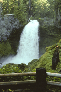
 Sahalie Falls
Rating: ****
Form: segmented
Magnitude: 99 (h)
Access: auto (page 276)
USGS Map: Clear Lake (1998)
Edition: 1st
Sahalie Falls
Rating: ****
Form: segmented
Magnitude: 99 (h)
Access: auto (page 276)
USGS Map: Clear Lake (1998)
Edition: 1st
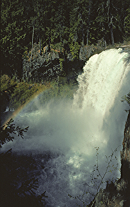 Koosah Falls
Rating: *****
Form: block
Magnitude: 95 (h)
Access: auto (page 277)
USGS Map: Clear Lake (1998)
Edition: 1st
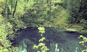 Tamolitch Falls
Rating: **
Form: punchbowl
Magnitude: 0
Access: trail (page 277)
USGS Map: Tamolitch Falls (1997)
Edition: 1st
More
Click Here for House Rock Falls (u), USGS Harter Mtn (1994 nl).
Output the CLICK HERE page to match your hardcopy book by changing your printer settings to 9" x 5 3/4".
Others
Use the following Waterfalls for Intrepid Explorers hyperlink to access an index for information on exploring the following waterfall yet to be visited by the author:
Heart Lake Falls (u), USGS Echo Mountain (1994 nl)
COPYRIGHT 2013 by Gregory A. Plumb
GUIDEBOOK published by
Mountaineers Books