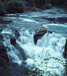
 Steamboat Falls
Rating: ***
Form: block
Magnitude: 47
Access: auto (page 302)
USGS Map: Steamboat (1997)
Edition: 1st
 Steamboat Falls
Rating: ***
Form: block
Magnitude: 47
Access: auto (page 302)
USGS Map: Steamboat (1997)
Edition: 1st
 Jack Falls
Rating: **
Form: tiered
Magnitude: 32 (l)
Access: bushwhack (page 302)
USGS Map: Steamboat (1997)
Edition: 1st
Update: Highway modifications are such that the unmarked turnout is now east of mile marker 42 at a riverside location 3.3 miles southeast of Steamboat Junction.
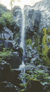
 Canton Creek Falls
Rating: **
Form: horsetail
Magnitude: 41
Access: trail (page 303)
USGS Map: Fairview Peak (1997 nl)
Edition: 2nd
More
Click Here for Little Falls, USGS Steamboat (1997).
Output the CLICK HERE page to match your hardcopy book by changing your printer settings to 9" x 5 3/4".
COPYRIGHT 2013 by Gregory A. Plumb
GUIDEBOOK published by
Mountaineers Books