 Rainbow Falls
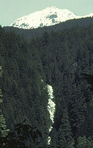
Rating: ***
Form: horsetail
Magnitude: 85 (h)
Access: trail (page 283)
USGS Map: Linton Lake (1997)
Edition: 1st
Rainbow Falls
Rating: ***
Form: horsetail
Magnitude: 85 (h)
Access: trail (page 283)
USGS Map: Linton Lake (1997)
Edition: 1st
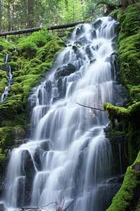 White Branch Falls
Rating: **
Form: fan
Magnitude: 21 (l)
Access: trail (page 284)
USGS Map: Linton Lake (1997 nl)
Edition: 4th
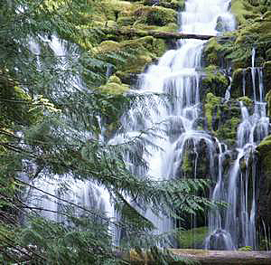 Upper Falls
Rating: **
Form: segmented
Magnitude: 28 (l)
Access: trail (page 284)
USGS Map: Linton Lake (1997 ns)
Edition: 1st
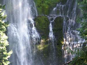 Proxy
Falls
Proxy
Falls
Rating: ****
Form: fan
Magnitude: 91
Access: trail (page 285)
USGS Map: Linton Lake (1997)
Edition: 1st
More
Click Here for Honey Creek Falls, USGS Linton Lake (1997 ns).
Output the CLICK HERE page to match your hardcopy book by changing your printer settings to 9" x 5 3/4".
Others
Use the following Waterfalls for Intrepid Explorers hyperlink to access an index for information on exploring the following waterfalls:
Obsidian Falls, USGS North Sister (1997)
Honey Creek Falls, USGS Substitute Point (1997)
Indian Holes Falls, USGS South Sister (1997)
Mosquito Valley Falls (u), USGS French Mtn (1997 nl)
Linton Falls, USGS Linton Lake (1997)
Access is unlikely to Shadow Creek Falls (u), USGS Linton Lake (1988 nl),
Mesa Creek Falls (u), USGS South Sister (1997 nl),
Upper Mesa Creek Falls (u), USGS South Sister (1997 nl),
Separation Creek Falls (u), USGS South Sister (1997 nl), and
Upper Separation Creek Falls (u), USGS South Sister (1997 nl).
COPYRIGHT 2013 by Gregory A. Plumb
GUIDEBOOK published by
Mountaineers Books